Artec Jet
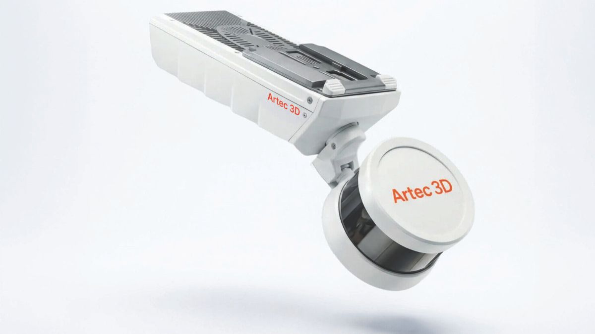
Capture infrastructure, facilities, and complex sites in minutes with accurate SLAM LiDAR mapping.

Flexible LiDAR Mapping Built for the Field
Artec Jet is designed for teams that need to capture large-scale environments quickly, accurately, and in real-world conditions.
With high-speed SLAM LiDAR mapping, survey-grade accuracy, and GPS-free positioning, you can digitize facilities, infrastructure, industrial sites, tunnels, road networks, and other complex environments in minutes rather than hours.
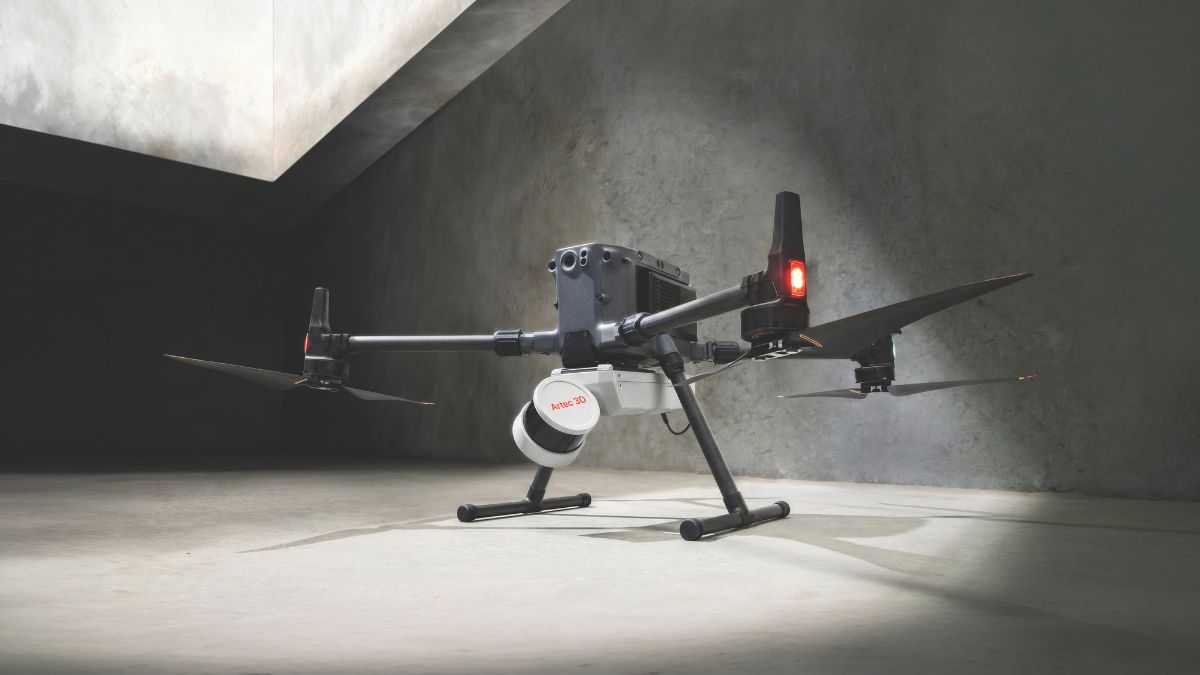
Artec Jet can be used by hand, deployed from a backpack, mounted to drones or vehicles, or integrated with robotic platforms to capture accurate site data across open-air, indoor, underground, hazardous, and hard-to-reach environments.
With real-time previews and on-site verification, teams can confirm complete data in the field, reduce rescans, and move faster into digital twin, as-built documentation, inspection, clash detection, and mapping workflows.
Key Benefits
High-Speed SLAM LiDAR Mapping
Capture large-scale environments in minutes with accurate, high-resolution LiDAR mapping.
Georeferenced Site Data
Use GNSS-assisted georeferencing to place scan data in real-world context for mapping and documentation workflows.
Large-Scale Data Capture
Scan indoor, outdoor, underground, and hard-to-reach environments with GPS-free positioning designed for real-world site conditions.
Configurable Scanning Setups
Choose the right configuration for the job, whether your team needs ground-level capture, aerial coverage, or scanning with drones, vehicles, or robots.
360° Scene Capture
Capture full-site context with 360° panoramic imagery that adds visual detail to LiDAR data, making it easier to review, document, and understand complex environments. Compatible with Artec Twins software and Autopilot solutions.
On-Site Scan Verification
Review point cloud data in the field to confirm complete capture before leaving the site, so you can reduce rescans and improve project turnaround.
Technical Specifications
|
Features
|
Artec Jet
|
|---|---|
|
Mapping Method
|
SLAM-based LiDAR mapping, ±0.03% drift
|
|
LiDAR Sensing Range
|
0.5–300 m (1.6–984 ft)
|
|
LiDAR Accuracy
|
±10 mm (3/8 in)
|
|
Mapping Accuracy (general)
|
±15 mm (19/32 in)
|
|
Mapping Accuracy (indoor/underground)
|
±10 mm (3/8 in)
|
|
Change Detection Capability
|
±5 mm (7/32 in)
|
|
Field of View
|
360° × 290°
|
|
Acquisition (single return)
|
Up to 640,000 points/second
|
|
Acquisition (triple return)
|
Up to 1,920,000 points/second
|
|
Max Travel Speed (vehicle)
|
60 km/h (37.3 mph)
|
|
Max Travel Speed (flight, above ground)
|
5 m/s (16.4 ft/s)
|
|
Max Travel Speed (flight, underground)
|
2 m/s (6.6 ft/s)
|
|
Start/Stop While Walking Or Hovering
|
Yes
|
|
Laser Class
|
Class 1 (eye safe)
|
|
Ingress Protection
|
IP65
|
|
Operating Temperature
|
-10 to 45°C (14–113°F)
|
|
Weight
|
1.57 kg (3.46 lb)
|
|
Power
|
14–54 V, 64W (battery or auxiliary)
|
|
Onboard Storage
|
512 GB (~16 hrs)
|
|
Quick Release Mount
|
Yes
|
|
Deployment Modes
|
Handheld, backpack, drone, vehicle, cage, telescopic pole, robot
|
|
Flight Modes — Pilot Assist
|
Non-GPS flight, position hold, assisted flight, collision avoidance, regulated flight speed
|
|
Flight Modes — Autonomous
|
Autonomous navigation to waypoints
|
|
AL2 Waypoint Types
|
2D, 3D, planar, height
|
|
AL2 Navigation Modes
|
Guided exploration, local and global path planning
|
|
Collision Avoidance FOV
|
360° × 360°
|
|
Collision Avoidance Range
|
1.2–40 m (3.9–131 ft)
|
|
Min. Obstacle Detection
|
≥2 mm wire
|
|
In-flight Adjustable Safety Distance
|
Yes
|
|
Return-to-Home
|
Low battery / excessive dust trigger
|
|
Auxiliary Port
|
Proprietary connector
|
|
USB
|
Yes
|
|
Wi-Fi
|
Internal antenna
|
|
Drones
|
DJI M300, DJI M350, Freefly Astro Max
|
|
Autopilot Compatibility
|
DJI M300, DJI M350, Freefly Astro Max
|
*Available by the end of 2026
**Available by June of 2027
Frequently Asked Questions
SLAM-based LiDAR combines laser scanning with simultaneous localization and mapping (SLAM) algorithms to scan and understand an environment at the same time. The LiDAR sensor captures millions of 3D points per second, while the SLAM algorithm tracks the scanner’s position and orientation as it moves. By matching geometric features in the environment, the system can build accurate 3D maps with the depth and context needed to capture complex spaces, including indoor areas, underground sites, and other GPS-limited environments.
With the Artec Jet 3D scanner, it uses industry-leading SLAM and AI-powered processing to deliver survey-grade accuracy, so you can scan and map at the same time, while on the go!
Artec Jet is ideal for large-scale scanning applications such as infrastructure inspection, surveying, digital twin creation, and industrial site capture.
Yes, Artec Jet is designed to be deployed on ground systems, UAV platforms, and robotic systems, making it highly adaptable across different environments.
No, Artec Jet is sold as part of a configurable solution that includes required accessories and software depending on the application.